Project Overview
This project was completed as part of the Digital Earth: Big Earth Data Concepts course (WS25). The aim was to explore the Copernicus Data Space Browser by applying a rule-based land cover classification to Sentinel-2 imagery using spectral indices.
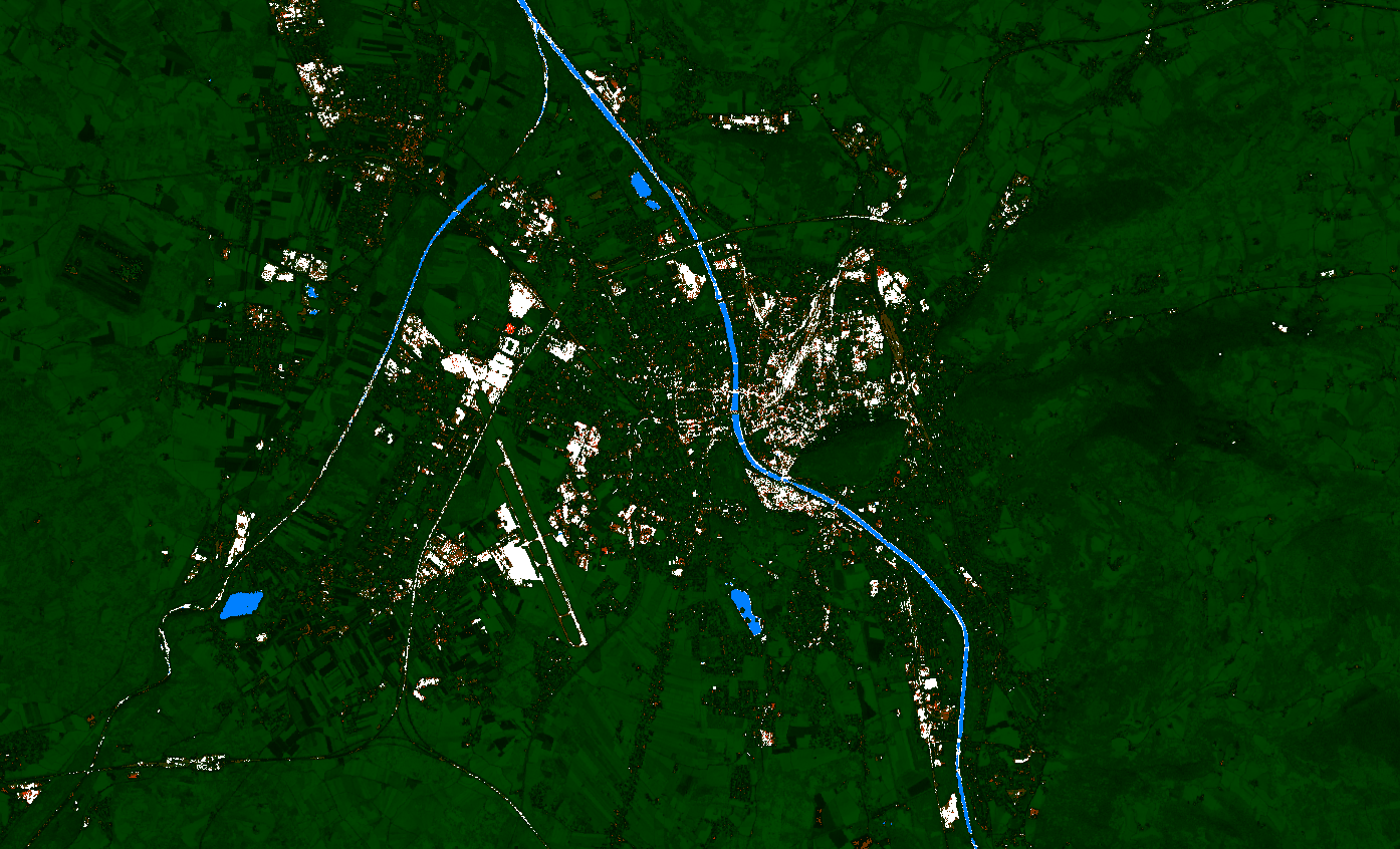
Data & Study Area
The analysis uses a Sentinel-2 image of Salzburg acquired on the 13th of November 2025.
Methodology
A classification script adapted from Šebela (2020) was used to distinguish between water, built-up areas, vegetation, and barren soil. The classification relies on a combination of spectral indices and threshold-based decision rules.
- NDVI: (B8 − B4) / (B8 + B4)
- NDWI: (B3 − B8) / (B3 + B8)
- BSI: 2.5 × ((B11 + B4) − (B8 + B2)) / ((B11 + B4) + (B8 + B2))
- SWIR: Sentinel-2 Band 11
Classification Logic
- Pixels with NDWI > 0.2 are classified as water.
- Pixels with NDVI < 0.1 and high SWIR values are classified as built-up.
- Pixels with NDVI > 0.2 are classified as vegetation.
- Remaining pixels are classified as barren soil.
Results & Discussion
The script performs well in separating barren soil from built-up areas, particularly in clearly defined urban and rural regions. However, as noted by Šebela, classification accuracy decreases in suburban areas where vegetation and housing are tightly mixed.