Project Overview
This project was developed as part of the Advanced Remote Sensing course (WS25). The objective was to compare two image segmentation strategies applied to a multispectral satellite image: the Mean Shift algorithm implemented in ArcGIS Pro and Multiresolution Segmentation (MRS) executed in eCognition.
Data & Study Area
The input dataset is a pansharpened SPOT satellite image from 2005. False color composite was used to visualise land cover types and vegetation health.
Segmentation Methods
Multiresolution Segmentation (MRS) groups neighboring pixels based on both spectral and spatial criteria such as shape, smoothness, and compactness. The scale parameter controls object heterogeneity and allows the creation of hierarchical object levels.
In contrast, the Mean Shift algorithm relies solely on spectral similarity, clustering pixels based on color and brightness without considering object geometry.
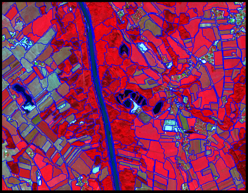
Main Result
The figure below shows the segmentation result generated in eCognition using multiresolution segmentation. The output clearly delineates agricultural parcels and produces polygon-like objects, making it well suited for object-based analysis and future machine learning applications.